
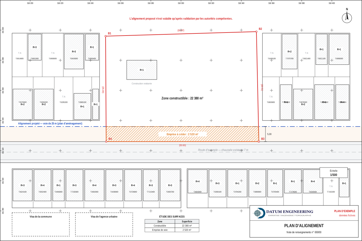
When it applies
- Building permit along a road.
- Purchase of land affected by a planned road.
- Check of an existing building.
Our work
- Documents. Zoning plan and road widths in force.
- Survey. Boundaries of the land and of the existing road.
- Plotting. Planned alignment, setback and public land take computed.
Examples of assignments
- Corner plot
- Road to be widened
- Alignment check of a building
What you receive
- Alignment plan in PDF and DWG
- Areas affected by the alignment
Reference framework
- ONIGT (National Order of Surveying Engineers) Standard 06 (alignment check)
- Zoning plan in force
Where we work
The firm is based in Aïn Sebaâ and works in the sixteen districts of Casablanca (Anfa, Maârif, Sidi Belyout, Al Fida, Mers Sultan, Aïn Chock, Hay Hassani, Ben M'Sick, Sbata, Moulay Rachid, Sidi Othmane, Hay Mohammadi, Roches Noires, Aïn Sebaâ, Sidi Bernoussi, Sidi Moumen), in Mohammedia, Bouskoura, Dar Bouazza, Nouaceur, Médiouna, Berrechid, Benslimane, Settat and El Jadida.
Further reading
Frequently asked questions
Does the alignment reduce the buildable area?
Yes, if a planned road encroaches on the land; the plan quantifies this part.