
For whom
- Public project owners and development companies.
- Design offices in charge of a route.
Our work
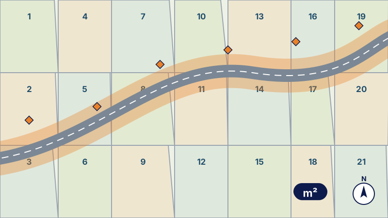
- Preparatory phase. Fitting of the route and the land take, estimate of the affected areas.
- Supplementary survey. Visible boundaries, fences, buildings, boundary markers.
- Land registry searches. Title, réquisition or unregistered land for each plot.
- Parcel schedule. Total and affected areas, presumed owners, occupation.
- Land files. One sheet per plot for the procedure.
Examples of assignments
- Tramway or bus line
- Road widening or bypass
- Land take of a pipeline or a sewer
What you receive
- Parcel plan
- Parcel schedule
- Land files per plot
Reference framework
- Law 7-81 on expropriation in the public interest
- ONIGT (National Order of Surveying Engineers) Standard 02
Where we work
Based in Casablanca (Aïn Sebaâ), the firm carries out this service throughout Morocco: Greater Casablanca, Rabat-Salé-Témara, Fès, Tangier, Agadir, the Oriental and the South. Its survey crews travel to the site for the duration of the assignment.
Projects of the firm
- Parcel schedule for an urban transport lineAffected areas, additional survey, parcel enquiry and schedule, and land files for an urban transport project.
- Parcel schedule for a road bypassParcel plan and schedule for the route of a road bypass, land registry consultations and topographic plan of the corridor.
Further reading
Frequently asked questions
Does the surveyor set the compensation?
No: he establishes areas and land status; compensation is a matter for the valuation commission and, where applicable, the court.