

Your situation
- A public project owner is preparing the acquisition of the land for a linear project.
- A municipality or a developer needs to know the land status of a zone to be developed.
- A landowner wants to understand how the area taken from their parcel was determined.
Parcel plan and parcel schedule
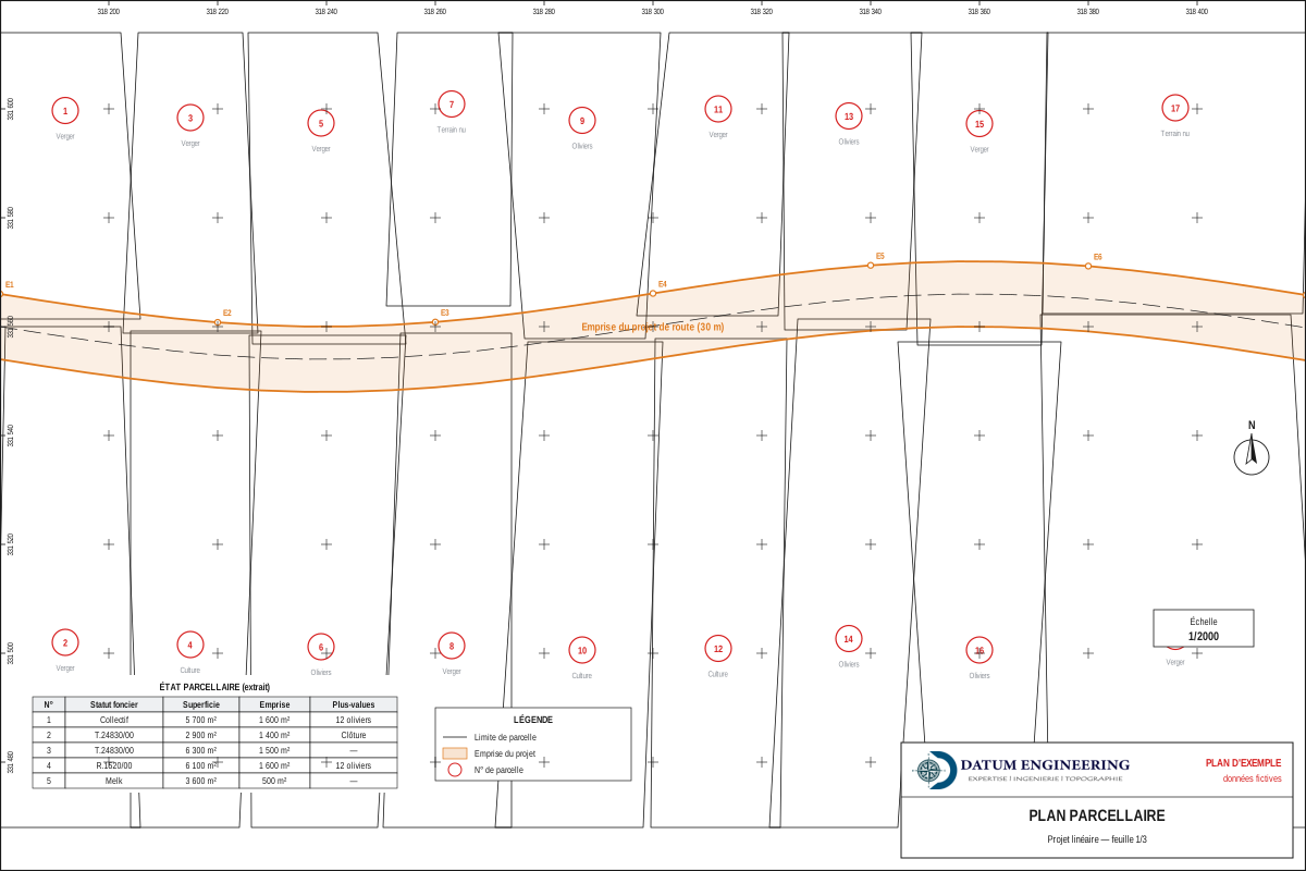
Under ONIGT Standard 02 (ONIGT: National Order of Surveying Engineers), the parcel plan identifies and describes all the parcels of a portion of territory; the parcel schedule summarises the legal and technical information gathered for each of them. The standard distinguishes isolated, linear (roads, motorways, pipelines, lines) and area-wide (dams, industrial zones) parcel surveys, and their purposes: land registration, land consolidation, expropriation or study.
How it proceeds
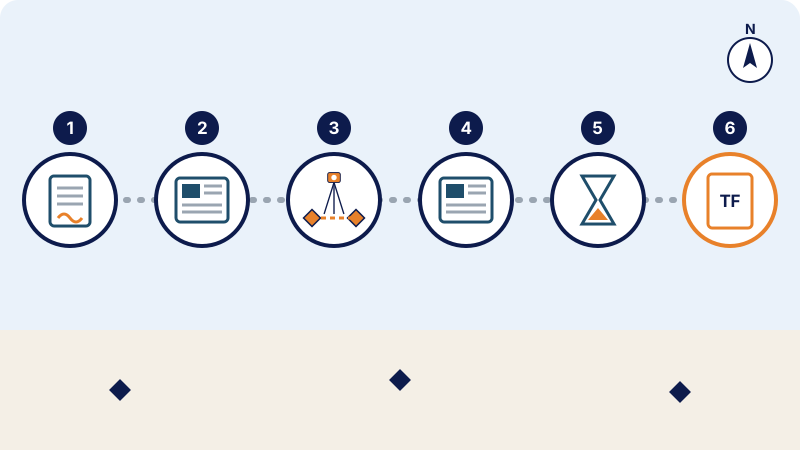
- Preliminary work: delimitation of the study area, administrative situation, land registry searches.
- Parcel reconnaissance on site, in the presence of the representative of the local authority, the owners and the rights holders: identification of the boundaries and the apparent owners, numbering of the parcels.
- Parcel survey at a place set in advance, to complete and correct the information; a record sheet is signed for each parcel.
- Topographic survey of the parcels and the land take.
- Parcel schedule and parcel plan, then a certificate from the local authorities attesting that the census was carried out in the presence of their representatives.
Content of the parcel schedule
- the municipality, the parcel number, its overall area and the area affected by the project;
- the land status (title, réquisition, unregistered land, collective land, State land…) and the encumbrances;
- the identification of the owner or the rights holders;
- the census of improvements: plantations and tree species, buildings, wells, crops.
The parcel plan
- at 1/2000 or 1/5000 in rural areas, at 1/500 or 1/1000 in urban areas;
- parcels drawn in solid line and numbered in continuous order, numbered boundary markers, boundaries inside the study area edged in red;
- Lambert grid, numbered sheets with an index of sheets.
Frequently asked questions
Are the owners present?
Yes: the reconnaissance is carried out in the presence of the local authority, the owners and the rights holders, and each record sheet is signed.
What happens in the event of disagreement about a plantation or a building?
The surveyor completes the record sheet with dated photographs of the assets concerned.
Does the parcel plan set the compensation?
No. It establishes the areas and assets affected; the assessment of compensation falls under another procedure.
Other useful guides
 Land registration in Morocco: the steps, from the réquisition to the land titleRéquisition, publication, boundary survey, objections and land title: the steps of land registration in Morocco under the 1913 dahir as amended by Law 14-07.
 Re-establishment of boundary markers: recovering the exact boundaries of your landMarker torn out or boundary disputed: how the surveyor re-establishes a land title's boundary markers, documents required and procès-verbal issued.
 Road and utility survey, as-built plan: surveying the street before and after the worksStreet survey before works and as-built plan after construction (ONIGT Standard 08): what is surveyed, limitations and deliverables for the design office.
Written by the surveying engineers of DATUM ENGINEERING, a firm registered on the roll of the ONIGT (National Order of Surveying Engineers).
General information article, based on the standards of the ONIGT (National Order of Surveying Engineers) and the ANCFCC (National Agency for Land Registry, Cadastre and Cartography) and on the texts in force on the date of update. It does not replace an examination of your file.