
Your situation
- You have built a building and wish to sell the apartments one by one.
- A buyer, or the buyer's bank, asks for the apartment's land title.
- Heirs wish to share out the apartments of a family building.
- You have added a floor and the title no longer matches what exists.
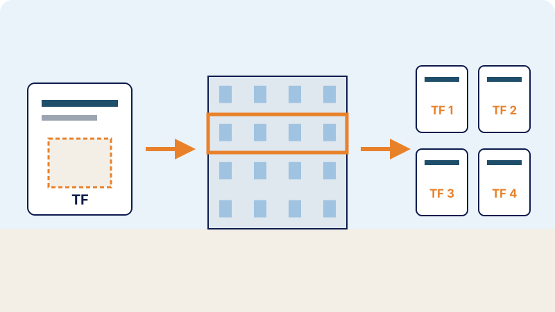
In all these cases, two operations are required: title reconciliation (mise en concordance) of the land title, then co-ownership, which leads to the splitting of the title into one title per unit.
What the regulations provide
Title reconciliation
It brings the land title into line with the situation on the ground: the surveying engineer identifies the boundaries and describes the current composition of the property (floors, built-up areas, outbuildings). It follows Standard No. 02/ANCFCC/DC of the ANCFCC (National Agency for Land Registry, Cadastre and Cartography) and never changes the boundaries or the area of the land.
Co-ownership
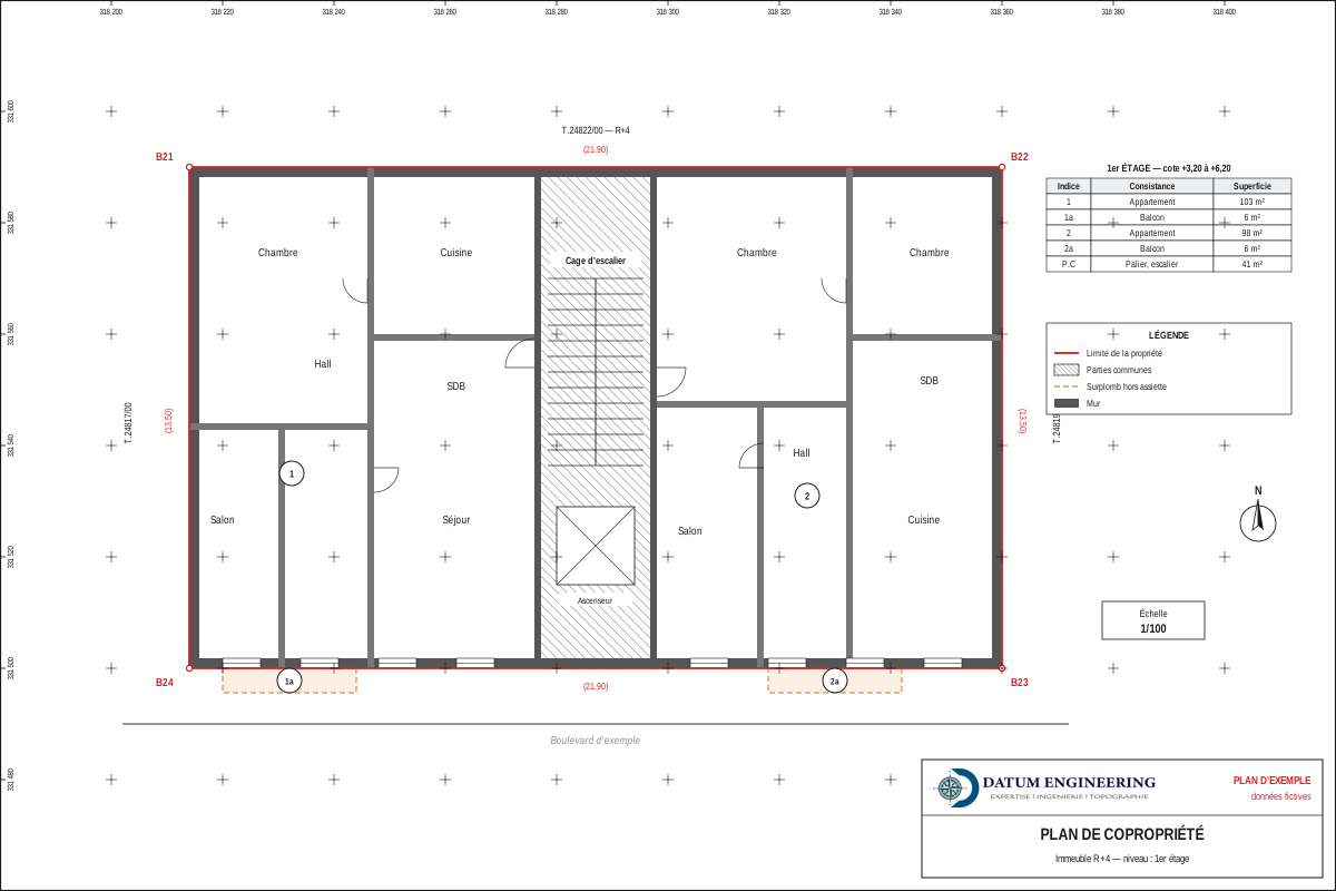
Governed by Law 18-00, as amended by Law 106-12, and by Standard No. 03/ANCFCC/DC, it divides the building into private parts (apartments, shops, offices, with their balconies and terraces) and common parts (stairs, entrance hall, load-bearing walls, shared roof terrace…). Each unit receives a share of the common parts and thousandths, calculated in proportion to its area.
How the file proceeds
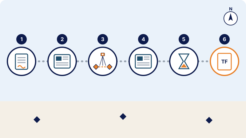
- Study of the title: consultation, at the cadastre, of the title file and of neighbouring titles (original plan, boundary markers, previous operations).
- Surveyor's contract, drawn up on the platform of the ONIGT (National Order of Surveying Engineers) and signed by the owner.
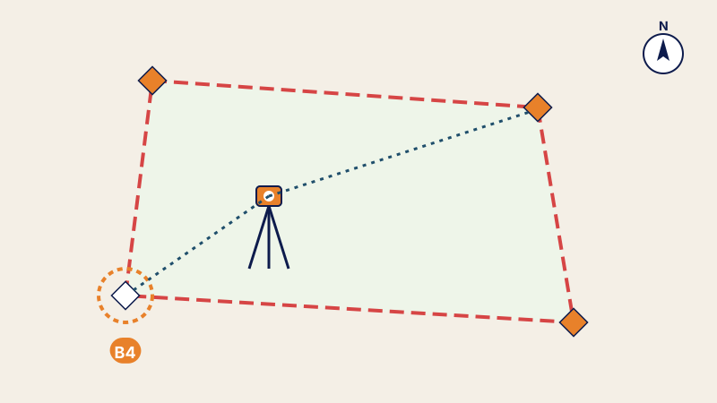
- On-site survey and boundary survey: search for the boundary markers, survey of the constructions on the boundary, boundary procès-verbal (official report) drawn up in the owner's presence, dated photographs of the façades and floors.
- Survey of each floor, from basement to roof terrace, with heights.
- Technical file: plan and synoptic presentation for title reconciliation; plan of each floor, descriptive division report, co-ownership regulations, schedules of units, shares, thousandths and votes for co-ownership.
- Certified signature of the co-ownership regulations by the owner.
- Electronic filing on the ANCFCC's Espace Cadastre & Cartographie, review by the Cadastre Department and handling of any comments it raises.
- Filing of the originals, then submission of the réquisition (request for entry) to the Land Registry (conservation foncière), which records the update and issues the titles of the various units.
Documents to prepare
- the land title number;
- a certified copy of the building permit and the approved “Ne Varietur” plan;
- the subdivision specifications (cahier des charges), if any;
- any specific administrative certificates (demolition, easement…) where applicable;
- the owner's identity document, or the powers of a company's representative.
Points to watch
- Balconies and overhangs above the public road: they form part of the unit and are described separately.
- Encroachment on a neighbour's land: reported in the procès-verbal from 1 m², it never enters into the areas or the thousandths.
- Consistency of the documents: areas, indices and designations must be identical on the plans, the schedules and the regulations; most of the cadastre's comments concern such discrepancies.
- Timescales: they depend mainly on the review by the cadastre and the Land Registry; a complete file at the first filing is the best way to shorten them.
Frequently asked questions
Does title reconciliation change the area of my land?
No. It updates the description of the constructions; the boundaries and the area of the title remain unchanged.
Can co-ownership be done without title reconciliation?
No: the title must first describe the building as built. If title reconciliation has not been carried out, it is filed together with the co-ownership.
What do the thousandths represent?
Each unit's share in the common parts, proportional to its area. They are used to apportion charges and votes at the general meeting.
Who can prepare this file?
A surveying engineer registered on the roll of the ONIGT, who signs the plans and the procès-verbaux.
Other useful guides
 Land registration in Morocco: the steps, from the réquisition to the land titleRéquisition, publication, boundary survey, objections and land title: the steps of land registration in Morocco under the 1913 dahir as amended by Law 14-07.
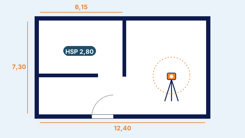 Interior survey: obtaining accurate plans of the existing buildingInterior survey of an apartment, premises or a building: plans of each level, areas, heights and files delivered to the architect.
 Re-establishment of boundary markers: recovering the exact boundaries of your landMarker torn out or boundary disputed: how the surveyor re-establishes a land title's boundary markers, documents required and procès-verbal issued.
Written by the surveying engineers of DATUM ENGINEERING, a firm registered on the roll of the ONIGT (National Order of Surveying Engineers).
General information article, based on the standards of the ONIGT (National Order of Surveying Engineers) and the ANCFCC (National Agency for Land Registry, Cadastre and Cartography) and on the texts in force on the date of update. It does not replace an examination of your file.