

When is it needed
- Earthworks interim statements on a site.
- Stockpile inventory.
- Capacity of a basin or a reservoir.
- Fill of a platform.
Our work
- Initial survey. Natural ground or reference state.
- Successive surveys. On the ground or by drone depending on the area.
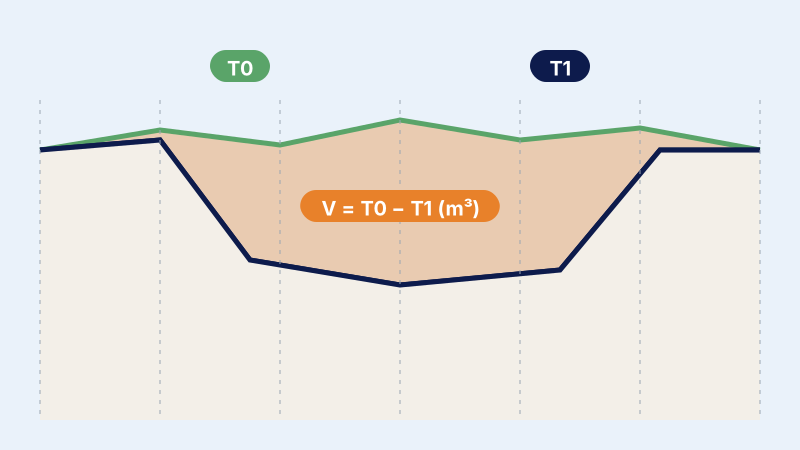
- Computation. DTM (digital terrain model) difference and cross-sections: two methods that check each other.
Examples of assignments
- Monthly earthworks statements
- Aggregate stockpile
- Irrigation basin
- Industrial platform
What you receive
- Initial and final topographic plans
- Cross-sections
- Volume summary sheet
Reference framework
- ONIGT (National Order of Surveying Engineers) Standard 03
- ONIGT Standard 12 (volume computation)
Where we work
Based in Casablanca (Aïn Sebaâ), the firm carries out this service throughout Morocco: Greater Casablanca, Rabat-Salé-Témara, Fès, Tangier, Agadir, the Oriental and the South. Its survey crews travel to the site for the duration of the assignment.
Projects of the firm
 Topographic control of earthworksTopographic control of the earthworks of a major facility: survey crew on site, checks and regular reports.
 Industrial building setting-out and monitoringInitial and final topographic plans, setting-out of axes and steel frame, and earthworks volumes for a building.
- Survey and capacity calculation of a basinAccurate topographic survey of a basin and calculation of its capacity to assess its sizing: method and deliverables.
Frequently asked questions
Why two methods?
They are independent: a discrepancy reveals a survey or model error.