
For whom
- Quarry operators.
- Control of extracted volumes by the authorities.
Our work
- Regular survey. Tie to the Lambert Morocco (Merchich datum) system, boundary markers, limits of the extraction area.
- Profiles. Long sections and cross-sections marked out so that they can be repeated.
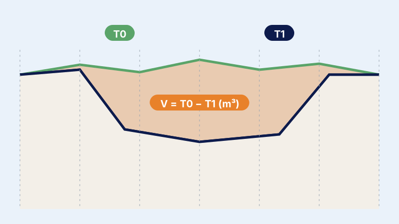
- Volumes. Difference between two DTMs (digital terrain models) and cross-sections.
- Sheet. Summary of volumes, plans and profiles, named according to the standard.
Examples of assignments
- Survey before extraction
- Periodic surveys after extraction
- Volume checks
What you receive
- Topographic plans
- Cross-sections
- Technical summary sheet of volumes
- DTM
Reference framework
- ONIGT Standard 12 (quarry monitoring)
Where we work
Based in Casablanca (Aïn Sebaâ), the firm carries out this service throughout Morocco: Greater Casablanca, Rabat-Salé-Témara, Fès, Tangier, Agadir, the Oriental and the South. Its survey crews travel to the site for the duration of the assignment.
Frequently asked questions
Can a quarry survey be carried out by drone?
The standard requires a ground survey with the required accuracy; the drone can supplement it over large areas.