
When is it needed
- Monitoring siltation of a dam reservoir.
- Capacity of a lake, a basin or a reservoir.
- Port basin before or after dredging.
- Wadi bed before a structure or bank protection works.
Our work
- Preparation. Survey extent, plan of sounding lines, water level benchmark.
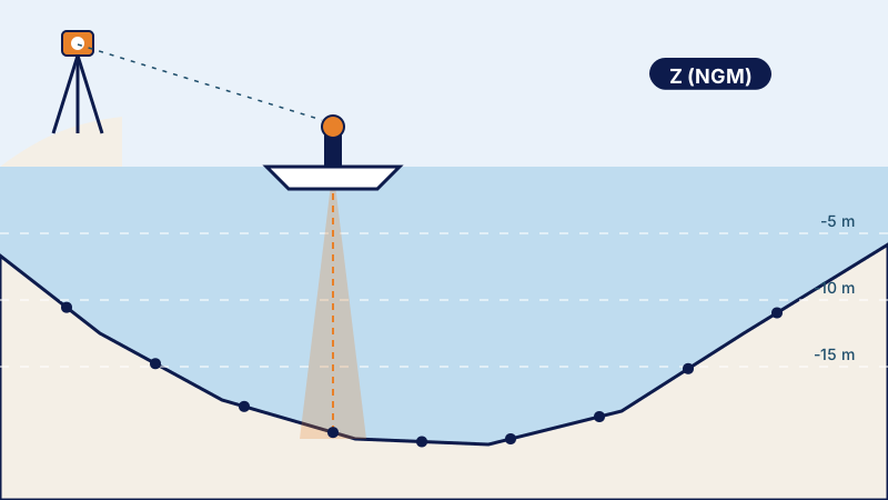
- Referencing. Reference points by GNSS, Lambert Morocco (Merchich datum) system and NGM (Morocco's national levelling datum); water surface level measured during the survey.
- Sounding. Boat fitted with an echo sounder coupled to GNSS, regular lines; single-beam or multibeam sounder depending on the depth and density required.
- Banks. Shallow areas and banks completed by land or drone survey, for a continuous model.
- Processing. Corrections (transducer draft, speed of sound, water level), digital model of the bed, depth contours.
Examples of assignments
- Siltation of a reservoir between two surveys
- Elevation–area–volume curve of a reservoir
- Port basin before dredging
- Wadi bed before a structure
What you receive
- Bathymetric plan and depth contours (DWG, PDF)
- Digital model of the bed
- Cross-sections
- Elevation–area–volume table
- Report: corrections applied and checks
Reference framework
- Accuracy standards of the ONIGT (National Order of Surveying Engineers) (Decision No. 68/98/ONIGT/CN)
- International Hydrographic Organization Standard S-44 where the specifications require it
- Client's specifications
Where we work
Based in Casablanca (Aïn Sebaâ), the firm carries out this service throughout Morocco: Greater Casablanca, Rabat-Salé-Témara, Fès, Tangier, Agadir, the Oriental and the South. Its survey crews travel to the site for the duration of the assignment.
Frequently asked questions
How is siltation measured?
By comparing the surveyed bed with a previous survey or with the initial survey of the reservoir: the difference in volume is the siltation.
Are the banks included?
Yes: they are surveyed on the ground or by drone and joined to the soundings.
In which system are the depths given?
As NGM elevations, which makes it possible to compare surveys with each other.